Kashmir’s Waters in Crisis: Ecology, Climate, and Society
Irshad Ahmad Bhat (Research Scholar)
The Kashmir Valley features a complex and dynamic hydrological system composed of rivers,lakes, and wetlands that support regional biodiversity,hydrological stability, and socio economic life. These aquatic systems ensure essential ecosystem activities such as water storage and management,nitrogen cycling,flood mitigation, and habitat provision.The valley’s waters have developed across geological periods because of interactions among tectonic activity in the Himalayan orogen, glacial processes, and climate variability. In recent decades,the integrity of this hydrosocial system has been significantly undermined by rapid climate change, unregulated urbanisation, encroachment, pollution, and alterations in land use. Scientific evidence extracted from remote sensing,longitudinal monitoring,and field evaluations indicates considerable degradation in the extent of water bodies, water quality, and ecological function, with profound consequences for environmental sustainability and human welfare.
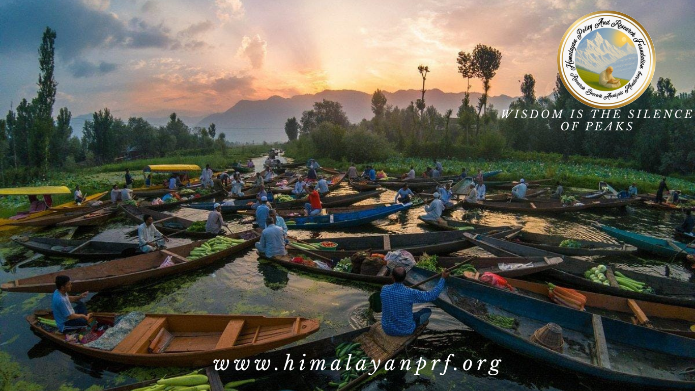
The Jhelum River,which integrates hydrological contributions from precipitation, glacial melt, and tributary inflows from the Pir Panjal and Greater Himalayan peaks, is the main river system in the Kashmir Valley.Functionally, the river underpins the distribution of water resources, sustaining extensive irrigation infrastructures critical for paddy cultivation, horticultural production, and associated export-oriented economies .Beyond its utilitarian role, the Jhelum has historically facilitated inland navigation and socio‑cultural connectivity, with shikara-based transport persisting as a salient emblem of the valley’s riverine cultural heritage. The river’s discharge dynamics historically interfaced with lacustrine and palustrine systems, including Dal Lake, Wular Lake, Manasbal Lake, and Hokersar Wetland, forming an interconnected network of water bodies that functioned as natural flood buffers while maintaining regional aquatic biodiversity
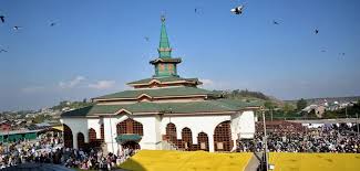
Dal Lake, located in the urban agglomeration of Srinagar, represents one of the most intensively studied lacustrine systems in the region.Conventional agricultural methods on floating gardens demonstrate profound socio-ecological adaptation to the lake’s limnological characteristics .Cultural narratives further illustrate the centrality of Dal Lake to Kashmiri identity; historical writers such as Amir Khusrau famously viewed the valley as paradisiacal, and literary expressions by mystics and poets such as Lal Ded and Mahjoor articulate water as both a metaphysical and ecological substrate of local life.
Despite its cultural importance, Dal Lake has gone through considerable ecological decline over the past forty years. Quantitative investigation titled Applied Water Science(2020),reveals that the lake’s open-water area diminished from roughly 14.37 km² in 1980 to 10.70 km² by 2018, representing a 25.5% decrease in surface area. Simultaneously,multiple sources counted that aquatic vegetation increased from 2.03 km² to 5.70 km²,demonstrating eutrophication processes induced by heightened nutrient inputs. These modifications correspond with the swift urban development in the lake’s catchment area; constructed land expanded from 20.15 km² to 38.6 km² during the same timeframe.The proliferation of urban infrastructure has intensified surface runoff, increased sediment load, and amplified nutrient influx, particularly nitrogen and phosphorus, which stimulate algal proliferation and deplete dissolved oxygen, thereby impairing water quality and aquatic life .Encroachment and construction along water body margins have emerged as critical drivers of hydrological and ecological instability. Studies indicate that large segments of Dal Lake’s littoral zones have been converted to built environments or reclaimed for tourism infrastructure, residential settlements, and commercial activities .Such encroachments compromise hydrodynamic connectivity, disrupt natural flushing mechanisms, and increase sediment deposition within the lake basin. Similar patterns are observed at other water bodies, including Wular Lake, where agriculture, plantation forestry, and unplanned settlement have truncated open water areas and fragmented wetland habitats .
Wular Lake, historically regarded as one of Asia’s most extensive freshwater lakes, has experienced significant contraction due to anthropogenic land‑use change. Early 20th‑century records described Wular’s maximum seasonal extent at approximately 217 km²; however, subsequent decades have seen substantial reduction of open‑water area due to sedimentation, agricultural reclamation, and encroachment along peripheral zones . Satellite data from 2008 to 2019 explain a persistent decline in water coverage, associated with reduced effectiveness of the lake’s flood mitigation capacity (NASA Earth Observatory, 2020). Simultaneous water quality assessments indicate extensive eutrophication, characterised by high nutrient levels and algae biomass indicative of compromised ecological conditions.
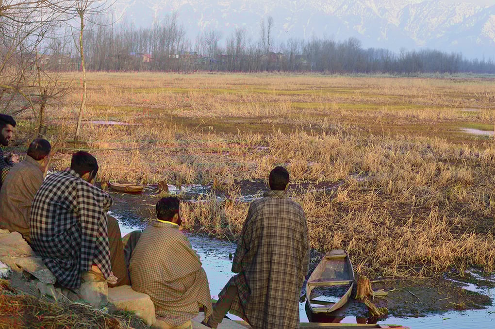
Wetlands like Hokersar, Haigam, and Shallabugh further substantiate the findings of systemic degradation. Hokersar’s analysis indicates a decline in marshland from 16.3 km² in 1969 to 5.62 km² by 2008, attributable to urban encroachment, agricultural land conversion, and infrastructure development (Mongabay India, 2018). Wetlands perform essential biological roles, such as water filtering, nitrogen sequestration, and groundwater recharge; however, their decline has significantly diminished the valley’s ability to regulate hydrological fluctuation and preserve water quality. Official reports indicate that Jammu & Kashmir has lost more than 57% of its wetland area from 2011 to 2021, a reduction attributed to ongoing human pressures and insufficient enforcement of existing conservation measures (J&K Wetland Management Authority, 2022).
Encroachment and unregulated building have exacerbated the physical and biological pressures on Kashmir’s water bodies. The transformation of aquatic land into constructed habitats reduces water surface area, impedes natural drainage routes, enhances sediment deposition, and alters biogeochemical cycling processes. The encroachment of the northern and eastern shores of Dal Lake for hotels, houseboats, and residential complexes has modified the natural shoreline shape and increased silt deposition, resulting in diminished depth and reduced water retention capacity. This trend has significant implications for flood risk, as diminished water body extents restrict the ability of natural basins to absorb and regulate peak flow occurrences.
Climate change adds additional costs by altering seasonal rainfall patterns and accelerating glacier melt in the upper catchment areas. Thayyen and Gergan’s scientific study of 2020 , indicated the Himalayan glaciers feeding the valley’s tributaries are retreating at rates that exceed the world normal average. This insensitive glacial recession changes when and how much water flows in rivers. This results into the spring melt to happen too soon,which leads to higher than normal discharge, followed by lower flows in the summer and monsoon seasons,which ultimately disrupts typical hydrological patterns. These modifications coincide with the rising frequency and severity of extreme weather events, proliferating the risks of both droughts and floods, placing significant stress on current water management infrastructures and ecological resilience strategies.
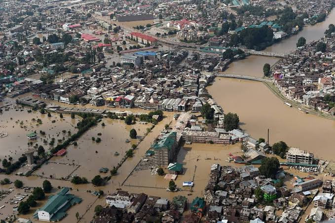
The floods of September 2014 exemplify the convergence of extreme meteorological phenomena and weakened ecological protections.Government reports indicate that the Jhelum River’s capacity was surpassed due to extraordinary rainfall, leading to widespread flooding throughout the valley, which caused considerable socio-economic losses, including community displacement and infrastructure damage, according to the Government of Jammu & Kashmir, 2015. Post flood assessments mitigation strategies highlight that the reduced capacity of lakes and wetlands, due to shrinkage and encroachment, significantly impacted the landscape’s ability to absorb surplus runoff, hence exacerbating the severity and duration of the flood event.
Beyond structural changes, anthropogenic pollution significantly undermines water quality and ecological integrity. Urban centers such as Srinagar generate significant quantities of solid waste and untreated sewage; studies illustrate that large portions of this waste enter rivers and lakes due to insufficient sanitation infrastructure.
Plastic litter,organic waste,and agricultural chemicals,including fertilisers and pesticides, contribute to elevated nutrient levels, enduring organic pollutants, and modified trophic structures in aquatic ecosystems. These inputs accelerate the eutrophication process , thereby, diminish dissolved oxygen levels, and jeopardise aquatic organisms, including indigenous fish species, amphibians,and macroinvertebrates.
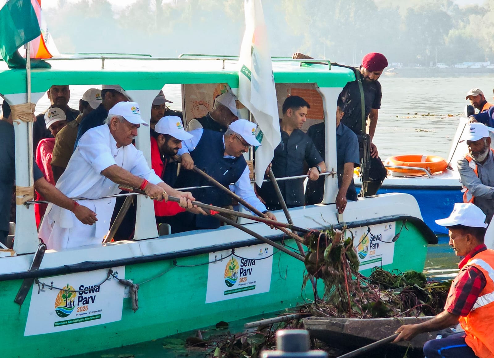
In response to these complex environmental concerns, institutional frameworks and policy tools have been established to safeguard and rehabilitate water bodies. The Wetlands (Conservation and Management) Rules (2017) provides a legal mechanism for the identification and regulation of wetland ecosystems, the delineation of buffer zones, and the restriction of activities that compromise ecological integrity.In this legal process, more wetlands, including Wular and Hokersar, have been formally recognised as environmentally vulnerable areas, with established land-use restrictions and monitoring obligations.Complementary initiatives, including the Dal Lake Eco-Restoration Project and the Wular Conservation and Management Plan, encompass dredging and desilting operations, sewage diversion and treatment enhancements, catchment afforestation, and community-based fisheries management, all aimed at mitigating pollutant inflows and improving ecological balance.
Catchment Area Treatment plans have been implemented as a targeted policy instrument to control soil erosion and reduce sediment movement by reinforcing unstable hill slopes through the integrated use of vegetative cover and engineered stabilization measures.The National Water Policy emphasizes the significance of integrated water resource management, watershed conservation, and the protection of wetlands as fundamental pillars of national water governance. These policy priorities emphasise the necessity for coordinated and cross-sectoral collaboration among environmental management agencies,water resource institutions, land-use regulators, and urban planning authorities to effectively tackle the complex factors contributing to the degradation of aquatic ecosystems.
Despite these policy measures, successful implementation is hampered by inadequate government coordination, weak enforcement of regulations,and insufficient local engagement. Environmental scientists and policy experts assert that just structural modifications are insufficient to rehabilitate ecological function.Restoration should be regarded as a socio-ecological process that necessitates continuous community engagement. As hydrologist S. Kumar asserts, “Ecological restoration in Kashmir must recognize lakes and rivers as part of a living system where human activity and natural processes co‑produce landscapes. Without restoring wetlands and regulating encroachment, engineered solutions will only offer temporary relief”. Societal engagement is therefore critical for the long‑term sustainability of water bodies.
Local stakeholders can enhance catchment protection via participatory reforestation, soil conservation, and watershed governance. Improvised waste management solutions, including decentralised sewage treatment, garbage segregation, and community-led clean-up activities, can reduce pollutants entering aquatic habitats.Sustainable tourism and boating activities can mitigate ecological footprints,while environmental education efforts can enlarge public understanding of water bodies as collective ecological and cultural resources.Citizen science initiatives, such as community monitoring of water quality and biodiversity, can augment official data systems, improve transparency, and foster collaborative stewardship.
The water bodies of the Kashmir Valley are dynamic socio-ecological systems, intricable interwoven with cultural, spiritual, and ecological contexts. The traditional representation of water as both life and identity, as illustrated in the poetry of Lal Ded and Mahjoor, underscores the deep connections between individuals and their surroundings. Protecting these ecosystems requires an integrated strategy that combines scientific restoration, strict policy implementation against encroachments, community participation, and the preservation of cultural values.The conservation of water bodies in Jammu and Kashmir necessitates resolute and sustained governmental interventions to guarantee their long-term vitality and ecological stability for future generations. Promoting human welfare and preserving the region’s cultural heritage.


A thoughtful and timely piece. The article rightly highlights how Kashmir’s water systems are deeply intertwined with its ecology, culture, and economy. Bringing attention to climate change, pollution, and unplanned development is crucial for shaping informed policy and collective action.
Thank you for your thoughtful feedback and for engaging with the article. We are glad the piece resonated with you. At our platform, we aim to encourage informed dialogue on critical issues such as Kashmir’s environmental sustainability.